Sentier de la Brague Walk
A half day hike taking in Valbonne & Biot villages
This enjoyable half-day hike follows a river linking two of the region’s most beautiful towns, Valbonne and Biot.
Access to this hike is quite easy - buses run from Nice to Valbonne and Biot so you can start from either end and still have time to explore both towns. They are both great for gift shopping and have plenty of good restaurants, so try to factor in lunch at either one of them. If you want to drive up then Valbonne is the better place to start as it has more free parking, there is also a bus that connects the two towns so you can get back to your car afterwards.
Our route is described from Valbonne to Biot, but you can do the hike in either direction and it is signposted from both towns.
What to bring
IGN map 3742OT is recommended for this walk
Directions
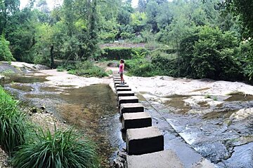
Once you’ve arrived in Valbonne head for the church and follow signs for the cimitiere (cemetery); the turn-off for the start of the hike is just before it on Avenue de Pierrefeu. The path heads off down to the river and within just a few minutes you’ll have come to your first bridge - a series of blocks that make stepping stones to the other side. The trail crosses back and forth over the river many times, look out for yellow paint on rocks and trees to see where you should cross.
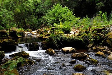
This path is fairly flat with some gentle undulations, it is mostly in the shade of dense forest which makes it a great walk for a hot day. The river is good for paddling in some parts where it runs quite shallow and we saw plenty of kids and dogs plunging in for a swim! The water is crystal clear and doesn’t seem to have a strong current - although the area is unsupervised so parents should keep an eye on children if they go in the water.
Depending on the time of year this hike is a forager’s dream - fig trees, blackberry bushes and wild mushrooms can all be found amongst the undergrowth. Look out as well for sculptures hewn into the rocks; we spotted two but we weren’t really looking out for them so there could have been more.
Old stone bridges, gurgling streams, wildflowers… it wouldn’t be a massive surprise to discover fairy folk dwelling amongst the twisty gnarled tree roots - it certainly has a very Tolkien feel to it.
The route is generally easy to follow but there is the odd junction where paths meet and it’s not always obvious which is the right one to take; you can see on the map where we doubted ourselves at one point and doubled back! As it turned out we could have taken either path as they met up in the end anyway, as is often the way. Keep looking for the yellow paint that marks the way and the general rule is that if you’re not sure just follow the river and you won’t go far wrong.
The only real climb is the last section up to Biot, it’s quite steep but only lasts 100m or so and then you can reward yourself with an ice cream in town!
